
My apologies if things around here feel like it’s “All Irma, all the time”, but when you have a storm of this magnitude in the neighborhood, it is.
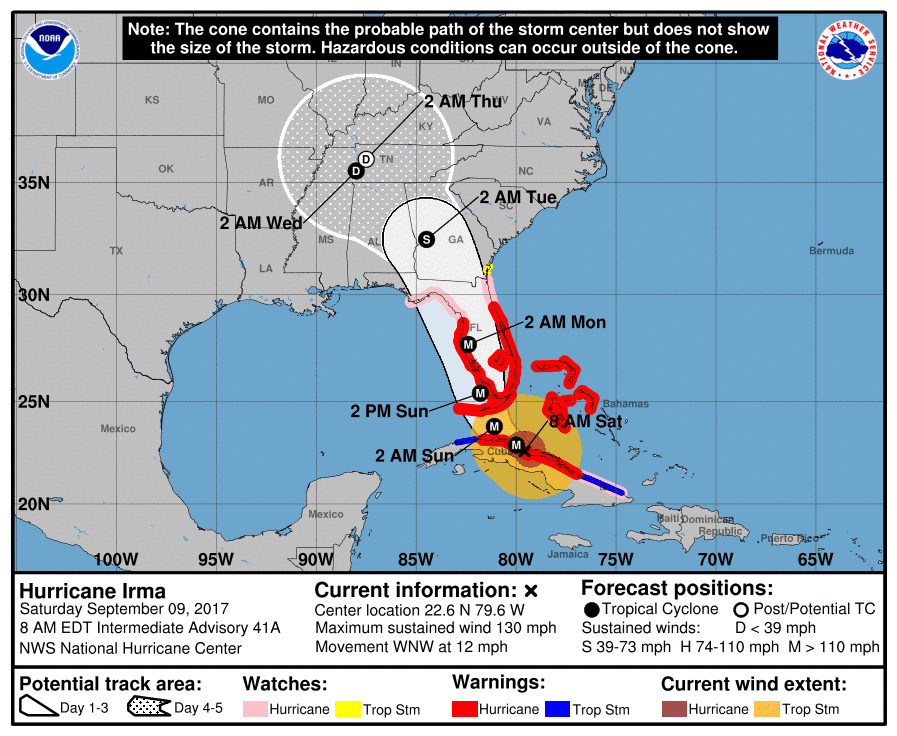
Irma’s predicted track continues to slide to the west. The Georgia coast is now out of the cone of uncertainty as is all of South Carolina and all but a tiny sliver of North Carolina. Given the storm’s size we’ll still feel the effects. At my location, the current forecast is for 24-36 hours of winds up to 35 MPH and 2+ inches of rain. Compared to what things looked like earlier in the week, I’ll take it.
However, I am mindful that others will now be getting the weather that I had expected. As you can see in the graphic, the cone of uncertainty is ballooning going into Wednesday/Thursday. This is likely in part due to the number days out on the forecast (chicken bones again), but it also due to the storm’s interaction with the continental land mass and interactions with other weather systems which themselves are only marginally predictable at this point. Also note that there is only a little movement predicted between Wednesday and Thursday–a Hurricane Harvey scenario. Let’s hope that some steering currents show up and keep her moving.
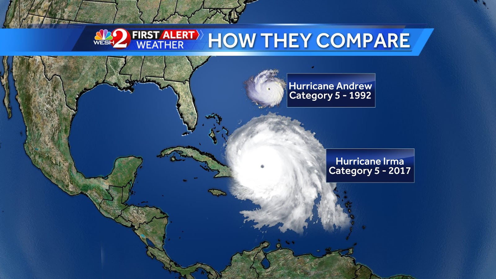
I also picked this tidbit up on Facebook. It’s from Eric Burris, a meteorologist with WESH-TV in Florida. It shows the sizes of Hurricane Andrew and Hurricane Irma. Note that, with Irma’s size, when the eye hits the southernmost part of Florida the outermost edge will be in central Georgia. This is one big storm. I know there is a lot of hype going on around it, but I don’t know that’s a bad thing this time around.
I’ll be back this evening after the 5 PM forecast is released. In the meantime, I’m still going through my prep routine, just in case the weather decides to throw me a big curve ball.
Edit, 9/9/2017, 18000: Irma has dropped to a Category 3 storm and her forecasted track continues to move to the west. This is causing some consternation in Florida, as areas on the Gulf Coast that apparently thought they would somehow magically be spared from a storm that can swallow Florida whole are now behind the curve in preparing to take the hit. Despite the fact I’m shaking my head in disbelief at such hubris, I wish them well in getting ready for the storm.
The outer bands of the storm are already over Florida and the storm is expected to strengthen. I’ve been watching various Florida webcams from time to time today. So far all that can be seen is wind, some rain and empty streets. It seems most people have taken this seriously.
The current forecast track appears to put landfall at or near the Tampa/Clearwater/St. Petersburg area. After making landfall, the track would have Irma continuing up the coast, passing between Birmingham and Atlanta, then over western Tennessee and curving into Missouri.
My home state of North Carolina is now completely out of the cone of uncertainty. Our weather forecast for the Monday/Tuesday period is now calling for winds no higher than 25 MPH and 1.3″ of rain total.
I won’t lie and say that I’m not perfectly happy to have this thing go somewhere besides here. I do hate it for the people who are in the path of it, because they are going to catch hell.
Given that, barring some seriously odd quirk of fate, Irma isn’t going to be much of an event here, I’ll stop inflicting my amateur coverage of it on you unless there is some major story that’s directly prepping related. I had hoped to have one of my own, but honestly this was about the same as getting ready for a major snow storm here, minus the snow. At least I had a good excuse to PM the generator.